 |
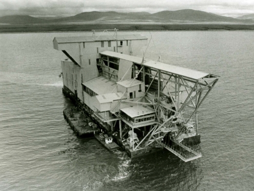
| Dredge at Flat Alaska |
In 1988, Dr. Paul Graff from Casper, Wyoming, stopped by my office at the University of Wyoming in Laramie. He was heading up a team to explore for gold in Alaska for WestGold (Western Gold Mining & Exploration) and needed someone with mapping, experience (you can skip the rest of this page since it is all about me kissing myself). I had a local reputation for detailed geological mapping & unravelling complex geological terrains while working at the Wyoming Geological Survey, and made some discoveries including a significant gold deposit within
Rattlesnake Hills gold district in central Wyoming, a deposit that is compared to the great
Cripple Creek gold deposit in Colorado. One major difference is that the Rattlesnake Hills Tertiary intrusives were emplaced within an
Archean age
greenstone belt, and greenstone belts are known worldwide as potential sources for gold.
To be honest, this was a super opportunity and I thank Paul for asking me as I had always wanted to see Alaska. What better way to see this grand state than to have WestGold pay my way and allow me to focus on rocks while we searched for gold. Besides, it was always an adventure and riot to spend time in the field with Paul - one of my favorite people!
As mentioned in 'Sarah Palin's Alaska', Alaska is beautiful with vast resources and few people. It is such a wonderful & honest state that I voted for McCain in 2008 only because he picked an Alaskan as a running mate. McCain, I could care less about. But Palin, I knew had to be honest (even for a politician) - she lived in Alaska where people had to work for a living unlike DC bureaucrats. She had my vote! Besides she was much more attractive than Obama and McCain.
Mapping in the middle of nowhere with only my .44 magnum as a companion, was my idea of peace. It was just like Wyoming, except wetter, no roads anywhere, no cows, and a plethora of giant mosquitoes, such that if these large buggers were found in Wyoming, the Game and Fish Department would have a hunting season for them: mosquitoes and noseeums would provide much entertainment in camp.
Being a
martial artist and exercise nut, I found they became a bit tiresome. I tried practicing
kata after working all day and used tree logs for curl bars and squats. As soon as I started to sweat or breathe heavily, it was a message for the 2 trillion mosquitoes within 10-square-feet to start a feeding frenzy. But I continued to train while wearing bug spray. However, bears would periodically show interest - so much so that we had to shoot one that was interested in trying to snack on one of our other geologists.
In the evenings, our team headed back to camp to spend time pulling pranks on one another and sleeping in tents while bears wondered around demanding handouts. I spent my 1988 and 1989 summers mapping in this wilderness thanks to Paul and WestGold. What a great couple of summers - something I would not trade for any amount of money.
In 1977, I started work on my goal to map most of the Wyoming's
gold districts,
greenstone belts,
kimberlite and
lamproite fields and search for
diamonds. By time I left the Survey in 2007 due to Gothic politics, I mapped >1,000 square kilometers of Wyoming's Precambrian complexes along with the lamproite and kimberlite fields that no one else wanted to work due to the complexities of resolving structural elements, units, metamorphism and alteration. Many of these terrains could be liken to someone ramming an automobile into a light post at 100 mph. Things were bent, broken, wrapped around itself and many parts were missing.
Even though other geologists avoided these terrains, I loved working these kinds of puzzles, and while mapping, I found some
new mineral deposits. I also mapped a few dozen underground mines that were left by miners as they search for other treasures. In some, I found old mine cars, lamps, gold anomalies, and in one, I even found where someone scribed the year in mud on the mine rib - 1915. So, I had some experience when I headed off to Alaska for two summers in 1988 and 1989.
 |
Gold nuggets from Julian
Creek placer found in 1988.
Largest nugget is 1 ounce. |
I published somewhere around a thousand books, articles, professional papers, maps and abstracts. Some
books I wrote on finding gold deposits (Hausel, 1989, 1991, 1997,
2009;
Hausel and Hausel, 2011) and some gold
articles I published led prospectors to find treasures. I had some experience in volcanic terrains. When I was at the University of Utah and University of New Mexico, Tertiary and Quaternary volcanic rocks were my specialty. And while working at the Wyoming Geological Survey, I explored volcanic rocks associated with the giant porphyry copper-silver deposits in the Absaroka Mountains, gold at the Mineral Hill district and in 1981, I had found a few dozen gold anomalies in the
Rattlesnake Hills greenstone belt. It is rare for a geologist to discover a new mineral deposit, and even rarer for one to find a whole new district!
The Rattlesnake Hills were missed by nearly everyone else, but I found gold at several locations in the district and in different types of deposits (Hausel, 1994, 1995, 1996). I predicted the district would yield large-tonnage, low-grade gold deposits due to presence of >40 Tertiary alkalic intrusives that erupted through the greenstone terrain, and because of the brittle breccias I found adjacent to Sandy Mountain and Oshihan Hill and the stockworks I found south of Oshihan Hill (Hausel and Jones, 1982a, b). Years later, I mapped the Leucite Hills volcanic field in southwestern Wyoming (Hausel, 2006).
So, I took leave from the Geological Survey and signed up for consulting and headed to Alaska in 1988. I had a great time and it worked out so well that I returned in 1989 - I love Alaska and can understand Sarah Palin's love for this state! But little did we know, we were about to discover one of the largest gold deposits on earth. And we were optimistic - something that is required (but lacking in most) for good exploration geologists!
According to the
mining history of Alaska, placer gold had been found in the Kuskokwim River basin in the 1800s. Prospectors worked the George, upper Holitna, Tuluksak, Salmon and Kwethluk rivers; the New York, Bear, California, Marvel, Taylor, Forty-seven, Canyon, Crooked, Julian, Donlin and Flat creeks; and Murray, Snow, Ruby, Quartz, Queen and Lewis gulches. The Nixon Fork mine, 30 miles northeast of the McGrath village, had limited production in 1917 and again in the 1950s. The deposit was a high-grade gold-copper skarn with at least 131,500 ounces of gold (Bluemink, 2009). Eighty miles north of the Nixon Fork, placers in the Ruby district yielded sizable nuggets including the largest found in Alaska (294-ounce nugget from Swift Creek discovered in 1998). Nuggets were also found nearby at Long, Poorman and Moose creeks. The presence of large nuggets suggests a possibility of nearby hidden rich lodes.
 |
Location map of Donlin Creek
discovery in SW Alaska |
Seventy-five to 100 miles southwest of McGrath, gold placers at Snow Gulch and Julian Creek were found in the Georgetown district - these would later become known as the Donlin Creek deposit. Placer gold was also found in nearby Omega, Lewis, Quartz, Ruby and Queen Gulch. This region attracted interest of geologists because of pristine the gold flakes found in the streams by prospectors and the fragile gold nuggets which suggested a nearby source. As a result, WestGold began exploration in this region in 1988 which led to discovery of a large, disseminated, gold deposit with associated with anatomizing granodiorite to rhyolitic dikes intruded into graywacke (Hausel, 1988, 1989a). Drilling over a few years identified proven and probable resources of 29.5 million ounces with an additional indicated resource of 10 million ounces. This was an Elephant (so to speak in the exploration business)! Donlin Creek had a gold resource similar in value to the legendary Homestake mine in South Dakota. Donlin Creek also hosts as much gold as has been mined in all of Alaska from 1869 to 2007!
,+Drilling+Group,+Me+in+front+sitting,+and+Graff+on+R.+-+Copy.jpg) |
Three geologists of WestGold's Donlin Creek -
Snow Gulch discovery team pose with drillers
and samplers at Snow Gulch in 1989. Rob
Rutherford (standing left), Paul Graff (standing
right) and W. Dan Hausel (sitting right).
The house was our country club. |
The Northern Miner reported Donlin Creek to be one of the largest undeveloped gold deposits in the world and the largest undeveloped gold deposit in North America. Based on 2009 plans, the property could become one of the largest gold mines in the world. Mine permit applications were submitted in 2009 and mine construction proposed by 2012.
The deposit consists of felsic sills and dikes that host gold in association with sulfides, quartz veinlets and breccias. Higher gold values are associated with arsenopyrite, stibnite and quartz in dikes and sills that intrude a thick sequence (>5000 feet) of folded Late Cretaceous graywacke, sandstone and shale. Plans are for a mine to yield 1.5 million oz/yr from ore averaging 0.07 to 0.08 opt Au.
 |
Flying into Flat, Alaska for July 4th
celebration, 1988. |
Other interesting anomalies in this region include gold at Julian Creek about 25 miles to the northeast with nearby felsic dikes in a similar setting as Donlin Creek, and mercury-gold anomalies at DeCourcy, about 8 miles west and placer gold at Flat Creek about 25 miles to the north-northeast are also of interest (Hausel, 1989b). While recently watching Gold Rush, Alaska on the discovery channel, I can't help but laugh at the antics of these wannabee miners.
Everything they do is exactly backwards of how gold prospecting and mining is done. It is very unfortunate that the Discovery Channel picked such inept miners to educate the public on gold mining and
prospecting. There are lots of good
gold prospects in Alaska, but one does not go out and buy a half-million dollars in mining equipment before these deposits are sampled.
At Donlin Creek, we found gold spread over a few miles (visit Donlin Creek, Alaska on Google Earth). Donlin Creek consists of northeast-trending mineralized dikes and sills in a region 1.2 miles wide and more than 5 miles long (T. 23 N., R. 49 W). The lode is Alaska's largest gold deposit which runs along a ridge east of Crooked Creek at the heads of Lewis, Queen, Ruby, and Snow Gulches. The deposit consists of calcareous shale and graywacke of the Upper Cretaceous, Kuskokwim Group which strike west-northwest and dip 10-50 degrees SW and are cut by a swarm of Tertiary age rhyodacite to granite-porphyry sills and dikes that trend northeast (Hausel, 1988, 1989). Late northeast and northwest-striking, high-angle faults offset the mineralized zones (Miller and Bundtzen, 1994; Vaillancourt, 2002; St. George, 2004).
The deposit is developed in felsic dikes and sills, with lesser amounts of mineralization in graywacke, particularly where north-northeast trending fault zones intersect mineralized felsic intrusions and graywacke host rocks. The ore minerals are primarily gold-bearing arsenopyrite and arsenian pyrite which are disseminated in the felsic igneous rocks and in veins and networks of veinlets in the igneous and sedimentary rocks (Hausel, 1989b). The veins and veinlets consist of quartz and carbonate gangue, with gold and several ore minerals. The gold occurs mainly in arsenopyrite and stibnite (Hausel, 1989b). In addition minor chalcopyrite, cinnabar, cassiterite, covellite, galena, marcasite, molybdenite, native arsenic, pyrrhotite, sphalerite, scheelite occur in minor amounts.
 |
Dr. Paul Graff admires old hydraulic 'Giant' at Fullerton
Alaska in 1988. |
The gangue and alteration minerals include crystalline and chalcedonic quartz, carbonate minerals and dickite. Garnet and high tin in some granite porphyry dikes indicate that at least part of the intrusive suite is peraluminous. Based on crosscutting relationships, altered carbonated mafic dikes initially intruded followed by intermediate and felsic dike intrusion. Other than clay, weak sericitic alteration and disseminated sulfides, there is little evidence of thermal alteration of the host rocks (Bundtzen and Miller, 1997). Miller and Bundtzen (1994) report that the felsic dikes vary from 65 to 71 Ma. Gold is disseminated in sulfides, sulfide veins, and in quartz-carbonate-sulfide veining in sericitically-altered igneous rocks (Hausel, 1989b, Szumigala and others, 2000). There is a positive correlation between high fracture density, alteration, and the amount of gold.
Ore shoots are developed in dilatant zones along normal faults where faults steepen in felsic intrusions and graywacke. Alteration assemblages include sericite, illite, kaolinite. dickite, carbonate and pyrite (Hausel, 1989b, Szumigala and others, 2000). Current drilled resources places this deposit in the top 30 gold deposits known in the world (Novagold Press release, January 28, 2002). Its as large as the Homestake deposit, where more than 41 million ounces of gold were mined over a 100 year period.
 |
| Rehealed breccia of Kuskokwim graywacke adjacent to mineralized dikes. |
 |
Unusual nugget of gold. A rough gold nugget projects from
rounded granitic stream-worn pebble. Paul Graff considered
this type of gold may have grown in place in an organic rich
environment. According to placer miner Spencer Lyman,
several nuggets like this were found over the years in the
Kuskokwim Mountains. Other prospectors reported an unusual
regeneration of some gold placers that had all ready been mined. |
After finding such a major gold deposit, some people think our group of geologists became rich. Nope! Due to complexities of ownership and our company going defunct, the geologists on this project received 2 million mosquito bites, consulting fees and lots of fond memories.
But, in 2009, a group of seven geologists were awarded one of the greatest honors in economic geology - the Thayer Lindsley Award for a Major International Gold Discovery for our work at Donlin Creek. This honor now hangs in my dojo in Mesa, Arizona.
The Award presented at the PDAC in Toronto to recognize the accomplishments of
Mark Bronston, Richard Garnett, Paul Graff, W. Dan Hausel, Bruce Hickok (RIP), Toni Hinderman (RIP) and Robert Retherford. At today's gold prices, this 40 million ounce deposit is worth about $70 billion. And like any world-class property, once it is finally put into operation, more gold resources will be found and identified.
I dedicate this blog to one of our colleagues: Bruce Hickok, who was killed in an avalanche in Alaska. We will all miss Bruce.
I would also like to remember another geologist and friend - Ray E. Harris who passed away in Laramie apparently due to stress caused by activities at the Wyoming Geological Survey. From 2004 to 2006 the WGS had a staff of 26 people. Yet the agency suffered an 8% death rate in geologists, more than 20% heart related problems related to stress by the staff, 45% staff resignations, retirement, and transfer rate, and a 40% resignation rate of advisory board members. This was never investigated by the State of Wyoming. Cover up?


,+Drilling+Group,+Me+in+front+sitting,+and+Graff+on+R.+-+Copy.jpg)


